
There's something nice about the sun poking through the ever present thick grey clouds of a Cleveland morning, sipping coffee, going through the morning routine. Its all made better when people make the soundtrack for you. Cleveland = music, and when up here, I always end up digging around, or more so "remembering" that there's an endless amount of great stuff to find. Oh Asheville, you offer so much to the outdoorsy side of me, but your music scene is a barren plain of statement, populated only by extremely skilled musicians with little new to say.
Jai Paul - BTSTU (Edit) by Jai Paul
Up here for a few days, paying some favors to friends, landscaping the houses if it ever dries up enough or warms up enough, and spending the day/afternoon/night at the Cicli Polito fabrication shop touching up the front end of my bike. We were aiming for a short wheel base, and we may have over shot it, so its time for a slightly modified new fork to dial it in. Going boldly into new territory and loving the ride so far, and love that the building process is so flexible on this one. Finished product is eagerly awaited.
At 8:40 a lot of folks are up and over Black Mountain and well into their PMBAR day. For once I'm quite satisfied to be lumbering through the morning in the empty house of a friend, accompanied by strong coffee and a bowl of blueberries.
07 May, 2011

04 May, 2011
Working the Grades
This past weekend was a prime opportunity to return to Linville for some more work. Two days, no distractions, mid 70s, and zero rain. First up, Paradise Alley, a 5.8+ "not for the aspiring 5.8 leader."
Linville Gorge was in prime Mountain Laurel blooming season. From the top of Dopey Duck, we could see over Tilted World wall, spotted with pink blooms. Quite a site on both fronts. That's a steep wall.
 Having not climbed up that side of the canyon before, we went in prepared. Thus far the route descriptions have been adventurous at best. Sometimes two opinions are better than none.
 The first pitch is the crux, and Todd wanted it. Just fine. The going was slow. For 5.8+ this route get a little wider than I'd like it, and it was wider than Todd liked it either. And the right side of this corner gets up in your face pretty quick. I had to hang even cleaning it. Just don't have the fitness to climb pumpy stuff yet. Its early in the season, no?
 Job well done, Todd got a well deserved break at a decent belay station atop the first pitch, and sent me on my way (not pictured....as always). The going was easy, though I was never quite sure I was on route. The easy climbing in Linville is VERY easy. So easy that lichen gets to stick around. You are often climbing on lichen covered buckets, unsure of exactly where you are. Eventually I landed us a pretty nice ledge. Big enough to call and check in with Katy before her WORS race.
 Technical aside; been climbing with the Alpine Cock Ring as my new anchor choice. The A.C.R. for short.
 Three piece system, self equalizes, quick to set up, redundant via clove to the strongest piece, extension limited by shorting the longest leg with an overhand or 8 on a bite. If one piece blows, it looks like this:
 I'm happy with that. Other benefits, completely unmistakeable hot point, room for 3 carabiners (leader, tag line, second), and the cordelette COULD still be used like a standard set up with pre-equalization, or just wrapped around a tree, cut to do something interesting, and you have a rap ring at your disposal. Not bad.
Todd drew p3, a 5.7 romp up an overhanging wall with huge holds. And the route has more great ledges to give up. Including a great diving board overlooking the gorge atop p3.
 More bad pitches for Robb. I drew this crappy choss pile for p4. It was supposed to be 5.8. I think it had 4 feet of 5.8, followed by 5.nothing. It did have the cool opportunity to step across a chasm 200 feet up. The first 3 pitches are actually on a buttress detached from the proper wall.
  Finished it up with little or no trouble. Communication is a little non existent on wandering, windy 4th pitches, and Todd got a loop of rope stuck around some crap rock and had to take a fall. I was 100ft away with no idea what was happening. I set up a huge leash on the anchor and walked down to see what was going on; found Todd hanging above the chasm looking non plussed. Route in the bag, we enjoyed some cold beverages we had hauled in. Saturday Done.

Okay, Sunday. A shorter version, because we really don't have any pictures. This problem needs to get fixed. The third pitch of Contruction Job, 5.9 offers some pretty aesthetic climbing. And I did it with the camera in my pocket. Its up there in the sandy brown rock, and the roofs above it, ending on a small ledge beneath the diving boards at the top. This photo shows mostly the first pitch.
 The technical crux was the arching dihedral moving through the lighter colored rock. A couple thin finger moves up the arching crack, some balancy footwork stepping across some blank rock to a crimper, and then continuing on above your gear to some good holds and solid gear. After that, its some hopefully quick moves up very steep roofs. The holds that mother nature has left up there are unbelievable. Cutting your feet off into the air, above your gear, and not really worrying about; priceless. Easy terrain with enough gear, but the overhang, and exposure makes it amazing. I want it again, just going to have to find someone else who wants to go back. Todd got to second all the fun.
 While he was up to that, I got to hang out and watch vultures ride thermals on yet another great A.C.R. anchor.
 Exhausted, both mentally and physically from the third pitch, I headed home for a little recovery. I say a little because monday at 7 a.m. was another CrossFit class, followed by an early shake down of the new Cicli Polito ride. More on that later. No rest for the wicked.
 (and Pisgah Works now has wool available. New wool hoodies; nights are still cool, plus, you know you'll want one when fall rolls around again.)
Linville Gorge was in prime Mountain Laurel blooming season. From the top of Dopey Duck, we could see over Tilted World wall, spotted with pink blooms. Quite a site on both fronts. That's a steep wall.

 Having not climbed up that side of the canyon before, we went in prepared. Thus far the route descriptions have been adventurous at best. Sometimes two opinions are better than none.
 The first pitch is the crux, and Todd wanted it. Just fine. The going was slow. For 5.8+ this route get a little wider than I'd like it, and it was wider than Todd liked it either. And the right side of this corner gets up in your face pretty quick. I had to hang even cleaning it. Just don't have the fitness to climb pumpy stuff yet. Its early in the season, no?
 Job well done, Todd got a well deserved break at a decent belay station atop the first pitch, and sent me on my way (not pictured....as always). The going was easy, though I was never quite sure I was on route. The easy climbing in Linville is VERY easy. So easy that lichen gets to stick around. You are often climbing on lichen covered buckets, unsure of exactly where you are. Eventually I landed us a pretty nice ledge. Big enough to call and check in with Katy before her WORS race.
 Technical aside; been climbing with the Alpine Cock Ring as my new anchor choice. The A.C.R. for short.
 Three piece system, self equalizes, quick to set up, redundant via clove to the strongest piece, extension limited by shorting the longest leg with an overhand or 8 on a bite. If one piece blows, it looks like this:
 I'm happy with that. Other benefits, completely unmistakeable hot point, room for 3 carabiners (leader, tag line, second), and the cordelette COULD still be used like a standard set up with pre-equalization, or just wrapped around a tree, cut to do something interesting, and you have a rap ring at your disposal. Not bad.
Todd drew p3, a 5.7 romp up an overhanging wall with huge holds.
 And the route has more great ledges to give up. Including a great diving board overlooking the gorge atop p3.
 More bad pitches for Robb. I drew this crappy choss pile for p4. It was supposed to be 5.8. I think it had 4 feet of 5.8, followed by 5.nothing. It did have the cool opportunity to step across a chasm 200 feet up. The first 3 pitches are actually on a buttress detached from the proper wall.
  Finished it up with little or no trouble. Communication is a little non existent on wandering, windy 4th pitches, and Todd got a loop of rope stuck around some crap rock and had to take a fall. I was 100ft away with no idea what was happening. I set up a huge leash on the anchor and walked down to see what was going on; found Todd hanging above the chasm looking non plussed. Route in the bag, we enjoyed some cold beverages we had hauled in. Saturday Done.
Okay, Sunday. A shorter version, because we really don't have any pictures. This problem needs to get fixed. The third pitch of Contruction Job, 5.9 offers some pretty aesthetic climbing. And I did it with the camera in my pocket. Its up there in the sandy brown rock, and the roofs above it, ending on a small ledge beneath the diving boards at the top. This photo shows mostly the first pitch.
 The technical crux was the arching dihedral moving through the lighter colored rock. A couple thin finger moves up the arching crack, some balancy footwork stepping across some blank rock to a crimper, and then continuing on above your gear to some good holds and solid gear. After that, its some hopefully quick moves up very steep roofs. The holds that mother nature has left up there are unbelievable. Cutting your feet off into the air, above your gear, and not really worrying about; priceless. Easy terrain with enough gear, but the overhang, and exposure makes it amazing. I want it again, just going to have to find someone else who wants to go back. Todd got to second all the fun.
 While he was up to that, I got to hang out and watch vultures ride thermals on yet another great A.C.R. anchor.
 Exhausted, both mentally and physically from the third pitch, I headed home for a little recovery. I say a little because monday at 7 a.m. was another CrossFit class, followed by an early shake down of the new Cicli Polito ride. More on that later. No rest for the wicked.
 (and Pisgah Works now has wool available. New wool hoodies; nights are still cool, plus, you know you'll want one when fall rolls around again.)
27 April, 2011
Full use of Avery Creek
Wednesday was here. I was recovered from the weekend of road miles. I was at wits end negotiating my way out of underemployment with people who define shortly as: three months. I wanted to put in some more miles, get the Niner out in the woods, and do some fishing.
Cue Avery Creek.
A few weeks back I had finished off a larger loop in Pisgah with a descent down Avery, and passed a fisherman within the last two miles. We talked tackle, and this very novice fisherman put it in his head to have a go at it next time the opportunity arose.
 With a lite load of fishing gear, and some extra clothes, I headed down to the White Pines area, intending to go up Maxwell, and push over the top of Black. A downpour commensed at the Horse Stables and changed my mind. I was here more for the fishing, and if the forecasted storms had already started to reach us, I wanted to get on with it. So up Clawhammer in the rain became the plan.
 The rain stopped along the upper section of Black. Spring is ready to explode up here, with crocus, wild flowers, ferns, and some lillies all in various stages of their cycle. The trail was in great shape, the rain having offered great traction on the steeper sections.
 I stopped at the Black/Avery intersection to sure up the gear. The last thing I wanted was for my rod to go shooting off my back, or to catch a low branch and take me with it. The section of Black leading into this point, and the very beginning of Avery define Pisgah riding for me. Sections of steep, loose, rocky trail; water bars dropping off into V shaped gulleys; black organic mud turned to primordial ooze by a nearby spring; improbable downed logs made just passable by the impromptu engineering of a fellow trail rider. I don't ride it fast, but selecting a clean line down the whole trail has taken some time.
  Now that I wasn't just on a riding day, I took the time to hike down to the falls that you can hear down in the ravine after making most of the descent. Pretty impressive, and still flowing strong. I saw some tiny tiny Brooks swimming in the pool at the base. At least I knew there were fish up here.
  I wasn't alone in the wet forest. The area surrounding the base of the falls was littered with snails, probably enjoying its forever wet environment. They seemed to like Rhodo leaves, and there was no shortage of them down here.
On to the fishing. I ditched the bike a couple times and walked into the headwaters. I fished a few very technical little pools, doing little more than dropping a fly in for a few feet of drift. There wasn't much room to cast, and I was often almost sitting in the sprung branches of a Rhodo or Mt. Laurel to do so. Surprisingly I got a couple rises, and a bite, but was spooking fish two easily in the tight corridors.
Onto a larger pool, where I had some clearance to roll cast a bit, keeping my distance from the target. On my third cast I got a bite that stuck, and popped a small Brook a few feet above the water, and swung him back to me. I had him in my hand, and in an effort to get a photo, lost him. I threw a few more casts, and got nothing, and moved on.
Hit a few more pools down stream, going back to get my bike from time to time in case the storms hit. In a last ditch effort to actually land a fish, I returned to the pool where I had the bite. It had been over an hour, and everyone was feeling safe and hungry again. I got 3 or 4 instances where the fly was gulped from the surface of the water, but I was two slow, or had too much line out, to set the hook. And then finally; got one.
 So its definitely no trophy catch, but it is my first wild caught trout. Avery isn't hatchery supported, so these are genuine North Carolina trout, and its early in the year. They tend to spook easy, but bite on a less picky diet.
Feeling like I had had a full day, I switched back into my riding shoes, packed everything up, and finished off the rest of Avery, looking off to my left at all the stream left to explore.
Cue Avery Creek.
A few weeks back I had finished off a larger loop in Pisgah with a descent down Avery, and passed a fisherman within the last two miles. We talked tackle, and this very novice fisherman put it in his head to have a go at it next time the opportunity arose.
 With a lite load of fishing gear, and some extra clothes, I headed down to the White Pines area, intending to go up Maxwell, and push over the top of Black. A downpour commensed at the Horse Stables and changed my mind. I was here more for the fishing, and if the forecasted storms had already started to reach us, I wanted to get on with it. So up Clawhammer in the rain became the plan.
 The rain stopped along the upper section of Black. Spring is ready to explode up here, with crocus, wild flowers, ferns, and some lillies all in various stages of their cycle. The trail was in great shape, the rain having offered great traction on the steeper sections.
 I stopped at the Black/Avery intersection to sure up the gear. The last thing I wanted was for my rod to go shooting off my back, or to catch a low branch and take me with it. The section of Black leading into this point, and the very beginning of Avery define Pisgah riding for me. Sections of steep, loose, rocky trail; water bars dropping off into V shaped gulleys; black organic mud turned to primordial ooze by a nearby spring; improbable downed logs made just passable by the impromptu engineering of a fellow trail rider. I don't ride it fast, but selecting a clean line down the whole trail has taken some time.
  Now that I wasn't just on a riding day, I took the time to hike down to the falls that you can hear down in the ravine after making most of the descent. Pretty impressive, and still flowing strong. I saw some tiny tiny Brooks swimming in the pool at the base. At least I knew there were fish up here.
  I wasn't alone in the wet forest. The area surrounding the base of the falls was littered with snails, probably enjoying its forever wet environment. They seemed to like Rhodo leaves, and there was no shortage of them down here.
On to the fishing. I ditched the bike a couple times and walked into the headwaters. I fished a few very technical little pools, doing little more than dropping a fly in for a few feet of drift. There wasn't much room to cast, and I was often almost sitting in the sprung branches of a Rhodo or Mt. Laurel to do so. Surprisingly I got a couple rises, and a bite, but was spooking fish two easily in the tight corridors.
Onto a larger pool, where I had some clearance to roll cast a bit, keeping my distance from the target. On my third cast I got a bite that stuck, and popped a small Brook a few feet above the water, and swung him back to me. I had him in my hand, and in an effort to get a photo, lost him. I threw a few more casts, and got nothing, and moved on.
Hit a few more pools down stream, going back to get my bike from time to time in case the storms hit. In a last ditch effort to actually land a fish, I returned to the pool where I had the bite. It had been over an hour, and everyone was feeling safe and hungry again. I got 3 or 4 instances where the fly was gulped from the surface of the water, but I was two slow, or had too much line out, to set the hook. And then finally; got one.

 So its definitely no trophy catch, but it is my first wild caught trout. Avery isn't hatchery supported, so these are genuine North Carolina trout, and its early in the year. They tend to spook easy, but bite on a less picky diet.
 Feeling like I had had a full day, I switched back into my riding shoes, packed everything up, and finished off the rest of Avery, looking off to my left at all the stream left to explore.
26 April, 2011
The Cleveland Brutal Riding Tour
Maybe its because we watched "Until the Light Takes Us." Or maybe its because a few of the guys ride for Scum City Racing, a Black Metal infused alleycat/road/cyclocross team they've put together from the underbelly of Cleveland. Or maybe its just because it was over 80 degrees. Whatever the reason, this weekend was spent turning up the brutality day after day for a nice block of riding to kick off the season for the Cleveland crew.
Jay, Guy and George made it down after a late start (happy birthday Guy) on Thursday. We suited up quickly and headed out to stretch their car trip legs. We spun the river road out to Montford in a misting rain. As it started to get dark, we made our way up Sunset, to Old Toll, portaged around the road closure near the turn to Bent Tree. The views over Asheville lit up for the evening made it seem bigger than it was. We made Town Mountain just at dark, and made an interesting descent, with me nearly meeting my maker as a car came 6 feet left of center, and kept coming as we passed eachother.
Friday morning saw a wheel change for George after somehow breaking a spoke on Friday's ride. The kitchen was also whirlwind of activity. The guys know how to destroy a kitchen, make breakfast, and have it clean again in a matter of minutes. Fueled up, and bikes ready, we layered up for a chilly Friday ride in the upper 40s. Back out the River Rd., and through UNCA up to Kimberly. As we were bundled up eager to ride, we passed similarly bundled up folks eager to golf at the Grove Park course. Not a great golf day for sure.
Flat rolling terrain is the norm for these guys, so when given the chance, they just push it in pacelines on the stuff. So, having been out for about 30-40 minutes thus far, they thought they were well into their ride. I'm used to easing out along the river, and turning it on at the base of the climbs. Our two styles collided as we hit the base of Elk, and I told them the business was just starting. Elk was a nice introduction to climbing, and a tasted of what was to come. Weather was pretty stable on the way up, but after the summit, a fog, easily 10 degrees cooler, had rolled into the saddle above Bull Gap. We made the final descent down Elk to the BRP in a fog that barely allowed 15 yards visibility. My wool was covered in tiny droplets of water, and a few of the more unlucky guys were just wet and cold. We continued to drop down the Parkway, with barely enough visibility to feel comfortable on the descent, let alone see any of the views down into the Riceville valley. We made it back after a nice little 2+ hour ride. The guys had learned their lesson about pushing it out to the climbs. Cleaned up, and rested up, we rolled out to Pro Bikes for some supplies, Harvest Records for a little music, and to Ritrovo for some Pizza. The Pizza never stood a chance.
Saturday morning, early start, big plans. The first BIG ride of the trip. Killing two birds with one stone, Saturday's ride would start at 12 Bones South. It eliminates some boring, trafficked miles at the beginning/end of the ride, and allows us to end the ride with pork products. The Route: Sweeten Creek -> Mills Gap -> Concord Rd. -> Cane Creek Rd. -> Lower Brush Creek -> Upper Brush Creek -> Charlotte Hwy -> Hollywood Rd -> Garren Creek -> Morgan Hill -> Hwy 9 -> Chestnut Hill Rd -> becomes Old Fort Rd -> Charlotte Hwy -> Rose Hill -> Pinners Cove -> Mills Gap -> Sweeten Creek -> Ribs.
The first part of the route was a nice way to stretch yesterday's climb out of the legs. Rolling terrain, some short steep ups, long flat sections; perfect to ease everyone into the day. The Garren Creek climb starts out barely noticeable, easing its way out of the farmland. When the real business started, we regrouped at the last switchback for a snack, and finished it off without much difficulty. We spread out a bit on the descent, taking in the scenery, nice farms, a field filled with Shetland ponies, the creek running along the road. The Morgan Hill descent was as fun as ever. Wide open and fast at the top, some tight turns, and perfect road surface. I think someone sweeps the corners. The creek at the bottom was running high and clear, and made for a nice backdrop as we gathered together again after the descent. Hwy 9 gave Jay and I a chance to open it up a bit and we chased eachother up and over the first climb, regrouping on the long flat section, before taking off again on the second climb and regrouping again near the Straight-Away Cafe.
The climbs were starting to break the group up a bit, and we did our best to stick together over the multiple steep punches that Chestnut Hill throws. The long rolling tail of the road got us back to Charlotte Hwy feeling a little recovered. We took a break behind the nursery on Old Charlotte Hwy and ate a bunch of food. I gave out the last of my hydration to George, who was having trouble in the heat today. Making the left onto Rose Hill, I let the guys know what they were in for, and let the group spread out. Jay took off up the hill, with Guy sticking pretty close. I stayed in the middle, trying to keep an eye on George. Gotta protect your sprinters in the hills.
Some cramping, a little walking, lots of heat, and we all made the top, thankful to be there. The descent down Pinner's Cove starts extremely tight, and then opens up and dumps you into the valley, with a few rollers before getting back to Concord. Thankfully that intersection is at the top of Concord, and all we had to do was roll down, make a left, and order lunch. Lots of Ribs, grits, potato salad, some barbecue chicken, and a few beers washed the day way on the back porch of 12 Bones. The rest of the day was napped off at the house, while I ran out to Hickory Nut Gap for some more meat products for the evening's grill.
Sunday, Brutal Sunday. I think Jay asked for it, but I'm not sure he really wanted it. When this trip was planned a few months back, he wanted to do some things they'd never get to do in Ohio. How about a 10 mile climb with 6 miles of loose gravel? How about we do some steep climbing before that. And we'll introduce the whole day with some more gravel?
 Adding to the fun, I actually got up and did some mountain biking at Bent Creek in the morning. Katy and I met in the parking lot a year ago, to the day. I rescued a cute little out of towner from riding aimlessly around the forest. And the rest, is (little known semi-secretive) history.
 The road ride then started around 11:30 from the house. Route: River Road -> Broadway -> Through UNCA -> Up through Luella's BBQ to Kimberly -> Beaverdam Road -> Webb Cove -> BRP -> Ox Creek -> Reems Creek -> Maney Branch -> Paint Fork -> Barnardsville Hwy -> Dillingham Road -> Stoney Fork -> BRP -> Tunnel Road -> Home.
We kept it nice and easy for everything that wasn't a climb today. Rolled out nice and slow to Webb Cove, and stayed pretty much together. The first gravel climb was well received, no one was too put out by the extra effort needed, and all the seated climbing. Jay and I pushed it up the Ox Creek switchbacks, and we all descended into the Reems Creek Valley together, and eased along the flat section leading to the day's first steep climb. Jay had asked for a few sections to go off on hard efforts. I offered up the Maney Branch climb and he took it. After the rest of us snaked our way to the highpoint, Jay quickly admitted, "that hurt." Good. He's getting the full value day.
Another long descent down into Barnardsville, and regrouping in the valley below. Everyone was a bit low on water, and the thought that Easter Sunday may close my favorite Dillingham gas station entered my head. We pulled over under a bridge to cool off in the river. It was well over 80 degrees, and the last climb had been wide open, windless, and hot. The river gave everyone a chance to soak their legs, cool off, splash some water over themselves.
Thank goodness for the good 'ole boy gas station on Dillingham Road, and their willingness to be open on Easter Sunday. I think it saved the day, and offered some local color for our ride. There's always a few mechanic types in dirty overalls hanging on the porch, perfectly willing to talk bikes and mountains and gravel, as long as you can understand the dialect. I've been doing it a while, and still miss 80% of what comes out of their mouth. They always know how many people have been up Stoney Fork lately, and what condition it is in, and usually what the weather is like up top. They just site there like some kind of Oracles, but I'm ever thankful they do.
Ahh Stoney Fork. You Suck. I forget every time I go out there that its actually pretty unrelentingly steep, and now looser than ever. I stuck with Jay for a bit, but let him go to pull off and splash in two of the waterfalls on the way up. Eventually, I actually caught him, standing, dejected in the middle of the road. We remounted together, and then he needed another break. This break involved laying down in the road. I left from this point and finished it off, struggling to keep my bike upright, and tracking, in the loosest and steepest sections just before the final right hand turn. Happy to be on top, I turned back and watched for Jay. He emerged, broken, around the corner, one foot in front of the other, and bike next to him. Best quote of the day. "I don't know why you'd ever do this more than once." Jay had done Stoney Fork, and would never do it again. George was next, looking surprisingly good after yesterday's cramping and walking. I was imagining him coming up to me and punching me, but he was in good spirits. The top does a great job of erasing the last hour. Guy rounded the corner last, after having to walk a few stretches due to a pulled groin aggravated over the past few days.
It was a great climax to the weekend. I nice progression starting Thursday, and more or less ending Sunday at the top of Stoney Fork. The 40 minute descent back down to the 70 exit from the BRP came easy, stopping a few times for photos. The day was once again erased over a big meal, burgers and beers at UJ in West Asheville.
More than one of those guys will see Stoney Fork, or Rose Hill, or maybe the views from the Parkway in their dreams this week.
20 April, 2011
Multisport weekends over and over again.
Two plus years ago when I moved here, part of the motivation was that I'd be able to sneak climbing back into my life. Over the past decade I had gone from a dedicated/full time climber, living in my car at NRG or RRG, making lots of trips to Seneca, The Gunks, ADK, Red Rocks, Zion etc etc to a guy who owned a lot of climbing gear that mostly stayed in a rubbermaid bin.
Biking became easier. I was a messenger, then I was a sport racer, then I was training, using intervals and a trainer, and then I was racing pro/expert all over the country. Riding was just more accessible when I lived up north, and it squeezed climbing out; completely.
So with the move I've put myself 45 minutes from Looking Glass, Cedar Rock, Rumbling Bald, and an hour (or two) to Linville depending on which side of the gorge I'm heading to. Gotta say; Life is good again. I like the balance of riding and climbing I've found. And I've been consistent enough with the latter so that I'm no longer just frolicking up 5.8s anymore.
Case in point. Last weekend...going way back now...Todd and I climbed Flappin in the Breeze, 5.10a at the Flakeview Area of Rumbling Bald. The next day I rode with a team in from Atlanta, and did 6 hours of Pisgah riding. We stopped a bunch early on, extending the ride time, but I eventually just left the group and added on a section at the end. Black Mountain - Turkey Pen - Mullinax - Squirrel - SMR - Buckhorn - Black - Avery. Both days were things I felt really good about.
Flappin in the Breeze is at Flakeview area at Rumbling Bald, soaking in the sun. Three pitches go at 5.9+, 5.9+ and 5.10a. Both the 5.9+ pitches were harder than the 10a pitch, but that always seems to be how it goes. The gear was awkward, and sparse, and the gray area of 5.9+ is about my limit right now on gear. Climbing that many pitches at my limit is good for me. And, after a fall and early spring of throwing ourselves at 5.7s and 5.8s, it finally felt like Todd and I were climbing again.
 Looking down on some sparse gear on p2
After leading the second pitch, in a great headspace, I got to do the other enjoyable thing about climbing. Set up a belay on a comfy ledge, and sit back while Todd went and figured out the third pitch.
Fast forward to this past weekend. Saturday I did the Heartbreak+penalty miles ride with a couple folks (Sunday's post), and Sunday I made my way up to Linville to finally start exploring the southern end of the gorge, Shortoff Cliff. Linville style climbing is more up my alley than the climbing that western NC is known for. I just haven't found my rhythm on those slabby, friction domes of the Nose Area of the Glass, or even made the trip down to Green Mountain or Laurel Knob. I like to hold on to stuff. And I like vertical to overhanging rock.
Maginot's Line. A nice little 5.7+ to get acquainted with the area, and its supposed to be the best 5.7 in the state. Can't over look it. Linville promises Todd and I a nice progression through the grades, with classic 5.8s, 5.9s and 5.10s littered all over the cliff. Summer is going to be good. First we had to get there. After all the rain we'd had, the approach was a little wetter than usual. Todd ended up with a lap full of water on this move, and had to suffer through the first shaded pitch still soaked through. The approach is definitely a little rough, but it keeps the crowds down.
 Found our route pretty easily. Todd's up there, about halfway up the first pitch. The second pitch climbs up to the last chockstone below the giant diving board roof. Pitch 3 climbs out and around on to the face, for some great views. Pitch 4 is just a necessary evil to top out, 5.5 climbing and scrambling.
 Sidenote: we took my new half ropes out on their maiden voyage. At 8.4mm they tie some tiny knots, but no rope has ever handled as nicely as these for me. No longer having to trail a second line for raps is nice, plus the added redundancy you get from climbing on two ropes. I think its going to be a system that gets used quite a bit for everything more than simple cragging.
 Todd checking our scaled down guide book to see where pitch 3 went. You can see the burned out side of Linville Gorge below. The fire never jumped the river, so the other side of the gorge stands in stark contrast.
 More great ledges to hang out on and contemplate life. By the time Todd had finished up p3, I was finally in some much needed sun. For photo sake, I actually have to slip time here for a minute. I returned to the same climb on Tuesday, taking one of Katy's friends out for his first multipitch. Figured Maginot's would make a good introduction. There's great ledges at all the belays, it gives you full value adventure with the approach and the exposure, I had JUST climbed it two days earlier, and I wanted to do all the pitches, having gotten the short end of the stick on the weekend. SO....
 Here's a sharp end self portrait of me enjoying some pretty easy moves on beautiful rock in the sun on Pitch 3.
  Peter coming up behind me; enjoying the air beneath his feet and the friction of Linville's metamorphic sandstone. He's used to the super slick quartzite up at Devil's Lake, WI; this was an eye opening experience for him.
  More great ledges, this at the top of P3, looking north into the gorge. The upper gorge is definitely a little more scenic, but the logistics down here make for an easy day. We started kinda late, leaving the house at 9:30 or so, and were back at the house, with a beer stop, at 4:00. Nice lazy way to get 4 pitches of climbing in, see no one the whole day, and live in your hands and head for a day. Certainly no complaints from Peter.

Biking became easier. I was a messenger, then I was a sport racer, then I was training, using intervals and a trainer, and then I was racing pro/expert all over the country. Riding was just more accessible when I lived up north, and it squeezed climbing out; completely.
So with the move I've put myself 45 minutes from Looking Glass, Cedar Rock, Rumbling Bald, and an hour (or two) to Linville depending on which side of the gorge I'm heading to. Gotta say; Life is good again. I like the balance of riding and climbing I've found. And I've been consistent enough with the latter so that I'm no longer just frolicking up 5.8s anymore.
Case in point. Last weekend...going way back now...Todd and I climbed Flappin in the Breeze, 5.10a at the Flakeview Area of Rumbling Bald. The next day I rode with a team in from Atlanta, and did 6 hours of Pisgah riding. We stopped a bunch early on, extending the ride time, but I eventually just left the group and added on a section at the end. Black Mountain - Turkey Pen - Mullinax - Squirrel - SMR - Buckhorn - Black - Avery. Both days were things I felt really good about.

Flappin in the Breeze is at Flakeview area at Rumbling Bald, soaking in the sun. Three pitches go at 5.9+, 5.9+ and 5.10a. Both the 5.9+ pitches were harder than the 10a pitch, but that always seems to be how it goes. The gear was awkward, and sparse, and the gray area of 5.9+ is about my limit right now on gear. Climbing that many pitches at my limit is good for me. And, after a fall and early spring of throwing ourselves at 5.7s and 5.8s, it finally felt like Todd and I were climbing again.
 Looking down on some sparse gear on p2
Fast forward to this past weekend. Saturday I did the Heartbreak+penalty miles ride with a couple folks (Sunday's post), and Sunday I made my way up to Linville to finally start exploring the southern end of the gorge, Shortoff Cliff. Linville style climbing is more up my alley than the climbing that western NC is known for. I just haven't found my rhythm on those slabby, friction domes of the Nose Area of the Glass, or even made the trip down to Green Mountain or Laurel Knob. I like to hold on to stuff. And I like vertical to overhanging rock.
Maginot's Line. A nice little 5.7+ to get acquainted with the area, and its supposed to be the best 5.7 in the state. Can't over look it. Linville promises Todd and I a nice progression through the grades, with classic 5.8s, 5.9s and 5.10s littered all over the cliff. Summer is going to be good. First we had to get there.
 After all the rain we'd had, the approach was a little wetter than usual. Todd ended up with a lap full of water on this move, and had to suffer through the first shaded pitch still soaked through. The approach is definitely a little rough, but it keeps the crowds down.
 Found our route pretty easily. Todd's up there, about halfway up the first pitch. The second pitch climbs up to the last chockstone below the giant diving board roof. Pitch 3 climbs out and around on to the face, for some great views. Pitch 4 is just a necessary evil to top out, 5.5 climbing and scrambling.
 Sidenote: we took my new half ropes out on their maiden voyage. At 8.4mm they tie some tiny knots, but no rope has ever handled as nicely as these for me. No longer having to trail a second line for raps is nice, plus the added redundancy you get from climbing on two ropes. I think its going to be a system that gets used quite a bit for everything more than simple cragging.
 Todd checking our scaled down guide book to see where pitch 3 went. You can see the burned out side of Linville Gorge below. The fire never jumped the river, so the other side of the gorge stands in stark contrast.
 More great ledges to hang out on and contemplate life. By the time Todd had finished up p3, I was finally in some much needed sun. For photo sake, I actually have to slip time here for a minute. I returned to the same climb on Tuesday, taking one of Katy's friends out for his first multipitch. Figured Maginot's would make a good introduction. There's great ledges at all the belays, it gives you full value adventure with the approach and the exposure, I had JUST climbed it two days earlier, and I wanted to do all the pitches, having gotten the short end of the stick on the weekend. SO....
 Here's a sharp end self portrait of me enjoying some pretty easy moves on beautiful rock in the sun on Pitch 3.
  Peter coming up behind me; enjoying the air beneath his feet and the friction of Linville's metamorphic sandstone. He's used to the super slick quartzite up at Devil's Lake, WI; this was an eye opening experience for him.
 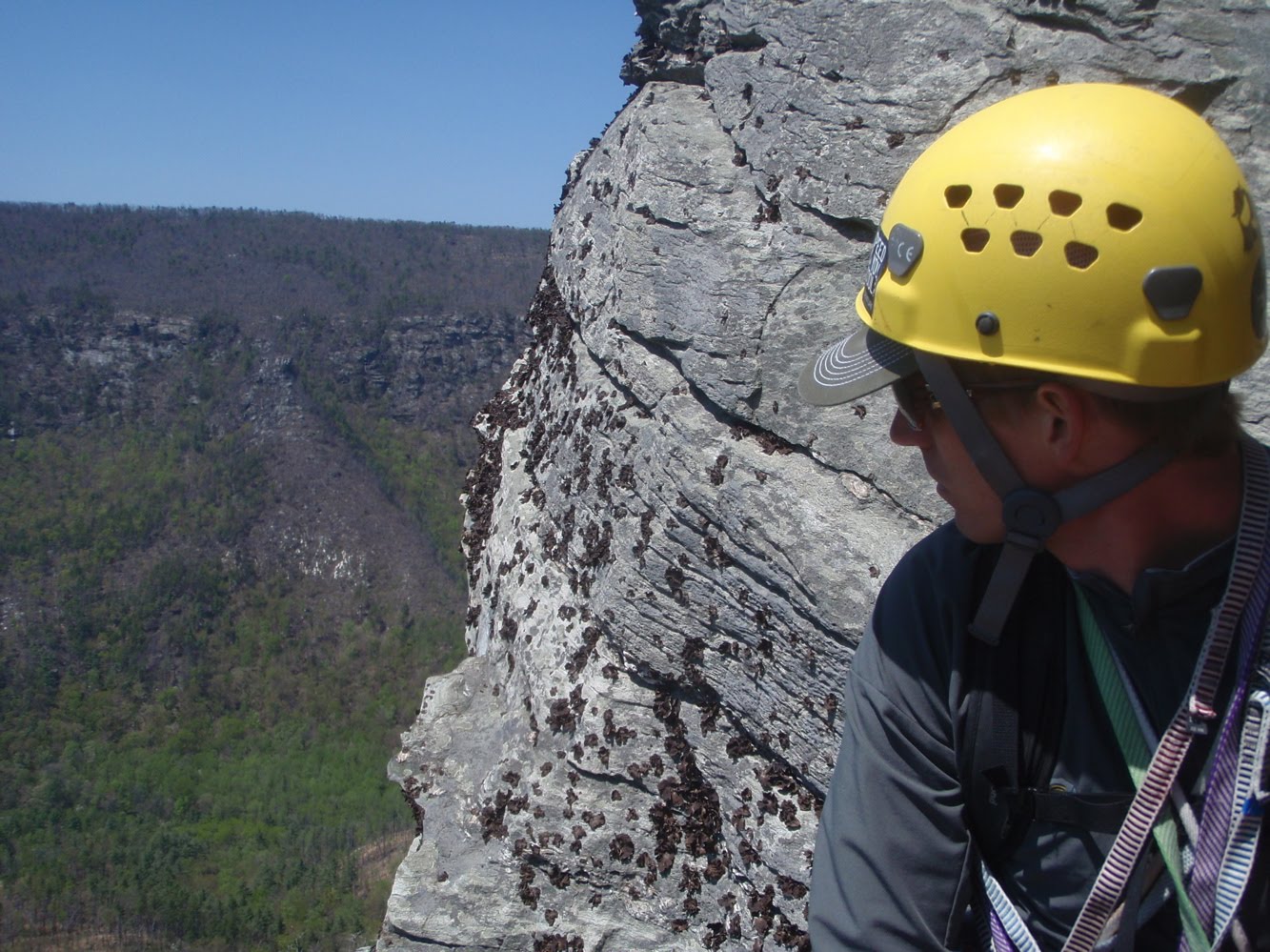 More great ledges, this at the top of P3, looking north into the gorge. The upper gorge is definitely a little more scenic, but the logistics down here make for an easy day. We started kinda late, leaving the house at 9:30 or so, and were back at the house, with a beer stop, at 4:00. Nice lazy way to get 4 pitches of climbing in, see no one the whole day, and live in your hands and head for a day. Certainly no complaints from Peter.
18 April, 2011
Springtime in Pisgah
Spring has brought forth its typical spread of wet weather. As it always seems to go in this land of the lush, the rain places itself nicely between the weekends, allowing us all to get outside and see how Friday's torrent has changed our landscape.
The on and off deluge that started Friday afternoon, extended into Saturday and threatened our riding plans. Wanting to DO something, I got up early and went to CrossFit. I believe this is this blogs introduction to CrossFit, something I've been doing since last September. It started as a Steve House inspired way to train for the climbing in Ecuador. Its continued beyond that as a way to train anaerobically, put on some lean muscle, work on flexibility, and stay in touch with my coaches on nutrition and stress management. CrossFit Asheville is one of the more complete CrossFit programs around from what I can see, and its more than just a bunch of people grunting out lifts.
Anyway, Saturday, 8:00 am was a "longer" CF workout, 15 minutes of work across 5 different stations. I bumped everything up; weights, jump heights, target heights for the workout so I was doing the prescribed workout, rather than scaling it. I was planning on burying myself and then crawling back home to enjoy a rainy Saturday. I finished the circuits and was shaking so bad my hand writing was illegible. Making breakfast seemed like an attainable goal.
 Plus
Plus
 Equals
 Thanks UPS. Everyone should be wary of paying for "insurance" when shipping; its a scam. So anyway....
 Called in a favor over at Niner, and got myself a shiny, not quite new, Sir9.
 The crew gathered, and took off on the rather flat road towards Montreat, and the Rainbow Road approach to Old Toll. Having complained about starting on the singlespeed from Ridgecrest, which throws you cold at Rattlesnake's steepest pitches within a mile, I wanted to try this more gradual approach. Just to get it out of the way; I'd rather do Rattlesnake. This is too long, too flat, and especially annoying after cresting the climb to Ridgecrest and then having to spinspinspin back to Black Mountain on 70.
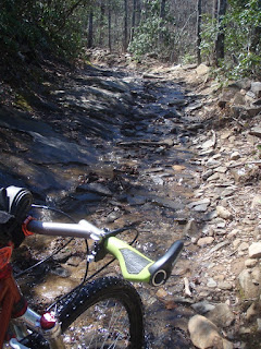 Theme for the blog, now many paragraphs in: water. Old toll was a running torrent in most places. "Lines" where they do exist in the rockier sections were all loose, baby head rocks having been deposited in a new home overnight on Friday.
  When it wasn't running, it offered the more juvenile among us the opportunity to play puddle splashing games. This resulted in about thirty sprints as folks jockeyed for position to launch themselves into a puddle on the right or left track, splashing anyone behind them or caught off guard next to them.

 "Hey Ed, where's that point on the ridge that I'm going to, in a stupor that can only be achieved by hours of anaerobic work sans breakfast, make a wrong turn and add the penalty lap?"
 "Right about there"
After two of our party flipped their ride, enjoying a very wet descent down Old Toll, Ed and I continued up. The early part of the Heartbreak descent was as fucked up as ever, and now wet as well. The ridge proper was in great shape. Tight tunnels of rhodo and mountain laurel occasionally giving way to gaps of blue sky. The Niner seems to descend well, and I'm loving my Manitou Minute on the front. It swallowed all the quick little roots of Heartbreak, and at 80mm, feels more stable on steep stuff than my old 10mm fork. On the way down, Ed had earned a little gap on me as a looked across the valley in a site seeing effort. In that same effort, I came up to Star Gap and dropped left. Something felt a little off, but this trail, new to me as a ORAMM virgin (I've saved enough to buy a new bike), felt a similar enough to the end of our normal Heartbreak loop that I didn't question it. Dry, woodsy, switchbacks, full shade, descending. Yep, this must be it. Dump out onto some grassy fire road: Nope, this ain't it. Back up all the switchbacks, found Ed at Stargap assuming I had suffered a skull fracturing crash, he had also climbed back up from the "true" end of the ride. Ahhh penalty miles. Wet, and getting colder, we dodged aggressive traffic up Mill Creek, and pedaled 32x20 and 32x22 (i'll claim the softer of those gears) along 70 back to Black Mountain. Clouds looming, a 40 mph wind reminded us never to use this modified route again on the single speeds. A decision that hardly effects my geared bike-less quiver. Goodbye Rainbow Road, it was nice to meet you.
Sunday I finally headed up to Shortoff to climb, something I've been wanting to do for the past 6 months. More on that later. This is too long as it is.
The on and off deluge that started Friday afternoon, extended into Saturday and threatened our riding plans. Wanting to DO something, I got up early and went to CrossFit. I believe this is this blogs introduction to CrossFit, something I've been doing since last September. It started as a Steve House inspired way to train for the climbing in Ecuador. Its continued beyond that as a way to train anaerobically, put on some lean muscle, work on flexibility, and stay in touch with my coaches on nutrition and stress management. CrossFit Asheville is one of the more complete CrossFit programs around from what I can see, and its more than just a bunch of people grunting out lifts.
Anyway, Saturday, 8:00 am was a "longer" CF workout, 15 minutes of work across 5 different stations. I bumped everything up; weights, jump heights, target heights for the workout so I was doing the prescribed workout, rather than scaling it. I was planning on burying myself and then crawling back home to enjoy a rainy Saturday. I finished the circuits and was shaking so bad my hand writing was illegible. Making breakfast seemed like an attainable goal.
Kicking back was the plan; until the email chain started going out for a late morning ride of Heartbreak. So 11:00am at the Dripolater in Black Mountain. That's a good 60 minutes of recovery. Perfect. Second new introduction; the Niner build. After four good years. and one tragic UPS accident that they denied over and over again, the Dieringer cracked, quite anticlimactically, on Sidehill Connector a few weeks back.
 Plus
Plus Equals
 Thanks UPS. Everyone should be wary of paying for "insurance" when shipping; its a scam. So anyway....
 Called in a favor over at Niner, and got myself a shiny, not quite new, Sir9.
 The crew gathered, and took off on the rather flat road towards Montreat, and the Rainbow Road approach to Old Toll. Having complained about starting on the singlespeed from Ridgecrest, which throws you cold at Rattlesnake's steepest pitches within a mile, I wanted to try this more gradual approach. Just to get it out of the way; I'd rather do Rattlesnake. This is too long, too flat, and especially annoying after cresting the climb to Ridgecrest and then having to spinspinspin back to Black Mountain on 70.
 Theme for the blog, now many paragraphs in: water. Old toll was a running torrent in most places. "Lines" where they do exist in the rockier sections were all loose, baby head rocks having been deposited in a new home overnight on Friday.
  When it wasn't running, it offered the more juvenile among us the opportunity to play puddle splashing games. This resulted in about thirty sprints as folks jockeyed for position to launch themselves into a puddle on the right or left track, splashing anyone behind them or caught off guard next to them.
 "Hey Ed, where's that point on the ridge that I'm going to, in a stupor that can only be achieved by hours of anaerobic work sans breakfast, make a wrong turn and add the penalty lap?"
 "Right about there"
After two of our party flipped their ride, enjoying a very wet descent down Old Toll, Ed and I continued up. The early part of the Heartbreak descent was as fucked up as ever, and now wet as well. The ridge proper was in great shape. Tight tunnels of rhodo and mountain laurel occasionally giving way to gaps of blue sky. The Niner seems to descend well, and I'm loving my Manitou Minute on the front. It swallowed all the quick little roots of Heartbreak, and at 80mm, feels more stable on steep stuff than my old 10mm fork. On the way down, Ed had earned a little gap on me as a looked across the valley in a site seeing effort. In that same effort, I came up to Star Gap and dropped left. Something felt a little off, but this trail, new to me as a ORAMM virgin (I've saved enough to buy a new bike), felt a similar enough to the end of our normal Heartbreak loop that I didn't question it. Dry, woodsy, switchbacks, full shade, descending. Yep, this must be it. Dump out onto some grassy fire road: Nope, this ain't it. Back up all the switchbacks, found Ed at Stargap assuming I had suffered a skull fracturing crash, he had also climbed back up from the "true" end of the ride. Ahhh penalty miles. Wet, and getting colder, we dodged aggressive traffic up Mill Creek, and pedaled 32x20 and 32x22 (i'll claim the softer of those gears) along 70 back to Black Mountain. Clouds looming, a 40 mph wind reminded us never to use this modified route again on the single speeds. A decision that hardly effects my geared bike-less quiver. Goodbye Rainbow Road, it was nice to meet you.
Sunday I finally headed up to Shortoff to climb, something I've been wanting to do for the past 6 months. More on that later. This is too long as it is.
01 March, 2011
Visuals
Two things visual today, and I know, I know, I know; I have two more climbs to write up. I'm finally back in front of the computer tomorrow being paid by someone else, so that'll be motivation enough to write up my Illiniza Sur (Plan B surprise) and Cotopaxi climbs.
First things first because I've committed so many words to the memory of my adventures, I'll grace these pages with some photos for viewing.
With that out of the way, how about some amazing typography. And you thought fonts weren't cool. I have to credit KS for getting me to watch this movie with her. You click on the stream now button on Netflix, the screen darkens, and the films races headlong into the opening credits. The rest of the film was an impressive visual statement for a first time filmmaker. If you like that sort of thing, and can handle some disturbing imagery mixed in with the filmmaker's visually ambient representation of the synthetic psychedelic experience, I highly recommend "Enter the Void."
And because I'm still listening to Kanye's record daily, I stumbled on to his "All of the Lights" video (I did so because my little bro worked on a remix of Monster. He plays in a band with Ben Bronfman from time to time, Ben's got access to the Kanye masters because of his production credit on a couple tracks. I liken it to the two Ratatat remix albums in that they left the vocal tracks pretty much untouched and put an instrumental layer to it. I like it.) Kanye no doubt had access to Enter the Void, and the team that did it, though in my little bit of looking I can't find the outfit. The downside of it is, with 9 million views, the Kanye video seems to be driving a lot of people to the Enter the Void clip, with its mere 179,000 views. People are going to get the wrong idea. This one comment is saving the day.
First things first because I've committed so many words to the memory of my adventures, I'll grace these pages with some photos for viewing.
With that out of the way, how about some amazing typography. And you thought fonts weren't cool. I have to credit KS for getting me to watch this movie with her. You click on the stream now button on Netflix, the screen darkens, and the films races headlong into the opening credits. The rest of the film was an impressive visual statement for a first time filmmaker. If you like that sort of thing, and can handle some disturbing imagery mixed in with the filmmaker's visually ambient representation of the synthetic psychedelic experience, I highly recommend "Enter the Void."
And because I'm still listening to Kanye's record daily, I stumbled on to his "All of the Lights" video (I did so because my little bro worked on a remix of Monster. He plays in a band with Ben Bronfman from time to time, Ben's got access to the Kanye masters because of his production credit on a couple tracks. I liken it to the two Ratatat remix albums in that they left the vocal tracks pretty much untouched and put an instrumental layer to it. I like it.) Kanye no doubt had access to Enter the Void, and the team that did it, though in my little bit of looking I can't find the outfit. The downside of it is, with 9 million views, the Kanye video seems to be driving a lot of people to the Enter the Void clip, with its mere 179,000 views. People are going to get the wrong idea. This one comment is saving the day.
05 February, 2011
Cayambe
Its now 6:30 pm in Quito and I´ve been awake since midnight. That´s how you climb when your route crosses the equator.
After a day of messing around on the lower glacier, lots of ipod time, food and naps at the hut at 15k, I settled into bed at 6pm. For 3 hours I tossed and turned with growing frustration; having to sleep is near impossible. Add in some harsh equatorial daylight and wind pouring through the leaky panes of the refugio, mixed with the anxiety of 19,000 feet, and rest doesn´t come easy.
Bryce woke me up at 12:00, planning on leaving in 30 minutes. We made some french toast, ate a few apples, and had some tea to warm us up. Bags were packed from the night before, and to save time we had harnesses and helmets on out of the hut.
The guide book calls this a 7 hour climb to the summit. Bryce says 7-9 or so for most of the times he´s been up. Its important to get off, or atleast well below the crevassed section up higher, before the very strong sun hits the route at 9am. The snow bridges become a gamble and crossing the larger crevasses below the summit becomes a non option. Thus the midnight start on all of these bigger climbs down here.
The first hour was a lot of hiking and scrambling. Relying on headlamps makes route finding a little tricky, as does the darkness of the new moon. We hit the glacier around 1:45, and cramponed up for the rest of the day.
This is my first actual glacier experience, having done a lot of vertical ice climbing in the past, but never walking on consolidated snow and ice at lower angles. It looks white and fluffy, but the 12 sharp points of your crampons barely make a dent. Your foot floats above the perfectly tractioned styrofoam surface. For 2 solid hours we made our way up the 35 degree slope neve and occasional hard ice. The lower glacier is pretty featureless, so there´s no crevasses, or noticable route denoters. Its just generally up. I´m sure Bryce was aiming at something, but in the dark, with 25 feet of visibility on acres of glacier, it just felt like one foot in front of the other, following the rope tied between us.
At 3:30 we ran into our first tricky route finding. A series of huge crevasses stood in our way. The plan from the start was to leave later than most of his clients because of the speed at which we´ve tackled the first two climbs. Rather than leave at 11:30 or 12, we slept in. The goal was to not reach this part of the climb until there was some predawn light. No luck. It was 3:30 in the morning and we were looking at a much changed crevasse feild since Bryce´s last summit a few weeks ago. This is rare for such a short time period, but glacial retreat via global warming is in full effect on the equator. Making it worse, recent snow had covered over everything, giving the illusion of solid ground, but actually thin snow bridges covering the large cracks in the ice.
With the help of my headlight, we spotted around looking for possible routes through the maze. We went left, up over a small ridge bordering a deep chasm of hard blue ice and found ourselves at a 3 foot wide, but very thin (according to Bryce) snow bridge across a 9 foot gap. The crevasse below was maybe 20 feet deep, and full of hard blue chandeliered icycle teeth. This is the only time in any of our climbs that Bryce has asked me to put him on belay. He stepped to the edge, with the rope kept tight, and darted across yelling back to me¨"think lite thoughts."
Minor challenge bested, we reached a point that he usually gets to via a different route, one that couldn´t be found in the dark and new snow conditions. A pitch and a half of vertical snow. The route description says 35 degree, but apparently the route has changed with the recent crevasse activity. This was 60 meters of 75-80 degree snow. Near vertical snow. Amazing to climb. The years of bullet hard Adirondak or Vermont ice with dulling crampons made this feel like climbing a ladder. Light kick with the foot, keeping the heel dropped to engage the secondary points, and you just kind of ran right up. Bryce and I simulclimbed this section tied short on our 30 meteres of rope, stopping to rest at the top under a nicely frozen overhanging wall of broken glacier.
We set a quick anchor, climbed one more pitch, moving seperatly, and had reached the end of the difficulty. We checked our watches, it was 4:45. We joked about, and then did, walk very slowly towards the summit. The goal being to have the sun rise while we were up there. Not much point summiting in the dark. Again, no luck. We got up there at 5:10 in the morning, fifty minutes before first light.
We piled on all of our clothes, sat on our packs, and moved in close, hoping to stay warm enough to wait it out. Sitting there in everything I had with me, slowly getting cold and falling asleep I called of our vigil. I knew it was for my benefit, but from a climbing perspective, it didn´t make sense. We were at 18,993 feet above sea level, probably 6k higher than I´ve been before this trip. No reason to sit around and see how my body reacted. Down we went, still guided by the LED beams of our headlamps.
More problems with the dark. We can´t find our descent point, which was at the top of that last pitch we did. Bryce had left two large snow pickets set for our use, but the 3 foot shafts of T-shaped aluminum were not making their whereabouts known. I led down off the summit, with Bryce´s direction, but we ended up well right of our point. Everything looks kind of the same up there. The only landmark a long crevasse that runs along the break from the summit dome. Its only 12-18 inches long, but it was 300 feet long. We remembered crossing over it, so we walked along it, occasionally looking down, and downclimbing looking for aluminum below. No luck.
I was getting pretty tired wandering around. Fitness always fails when a) your kind of lost and making no progress and b) you were convinced it was all downhill from here. We finally sat down again and waited for our accursed sun to rise so we´d have some light. Right around 6, in the ambient light coming around the horizon, we tried going far left, and 100 yards away saw two shiny pickets waiting for us at the top of a steep wall.
The down climb was uneventful, quick, and warm. We simul´d down the steep stuff. The daylight and overhead view allowed Bryce a better look at the crevasse feild, and we picked a much safer, and faster way through. We stripped off layers, and finally stopped for a snack in the warming sun, the thought having never occured to us before in the cold. Now everything around was lit up, and it was a rare clear day along the avenue of the volcanos. In the distance we could see Antisanna, Chimborazo (Tuesday´s climb), Cotopaxi (Friday´s Climb), the Ilinza´s (which i climbed last week) and a series of the other¨"big 10" down here. Lots of pictures and vistas on the way down made up for walking 6 hours in the dark. We finished scrambling down the last few hundred feet in view of the hut while hiding from the sun.
Route Details: Cayambe Standard Route: Grade II/PD 35 degree 1200m/3900 feet, summit height 5,789 meters, 18,993 feet.
After a day of messing around on the lower glacier, lots of ipod time, food and naps at the hut at 15k, I settled into bed at 6pm. For 3 hours I tossed and turned with growing frustration; having to sleep is near impossible. Add in some harsh equatorial daylight and wind pouring through the leaky panes of the refugio, mixed with the anxiety of 19,000 feet, and rest doesn´t come easy.
Bryce woke me up at 12:00, planning on leaving in 30 minutes. We made some french toast, ate a few apples, and had some tea to warm us up. Bags were packed from the night before, and to save time we had harnesses and helmets on out of the hut.
The guide book calls this a 7 hour climb to the summit. Bryce says 7-9 or so for most of the times he´s been up. Its important to get off, or atleast well below the crevassed section up higher, before the very strong sun hits the route at 9am. The snow bridges become a gamble and crossing the larger crevasses below the summit becomes a non option. Thus the midnight start on all of these bigger climbs down here.
The first hour was a lot of hiking and scrambling. Relying on headlamps makes route finding a little tricky, as does the darkness of the new moon. We hit the glacier around 1:45, and cramponed up for the rest of the day.
This is my first actual glacier experience, having done a lot of vertical ice climbing in the past, but never walking on consolidated snow and ice at lower angles. It looks white and fluffy, but the 12 sharp points of your crampons barely make a dent. Your foot floats above the perfectly tractioned styrofoam surface. For 2 solid hours we made our way up the 35 degree slope neve and occasional hard ice. The lower glacier is pretty featureless, so there´s no crevasses, or noticable route denoters. Its just generally up. I´m sure Bryce was aiming at something, but in the dark, with 25 feet of visibility on acres of glacier, it just felt like one foot in front of the other, following the rope tied between us.
At 3:30 we ran into our first tricky route finding. A series of huge crevasses stood in our way. The plan from the start was to leave later than most of his clients because of the speed at which we´ve tackled the first two climbs. Rather than leave at 11:30 or 12, we slept in. The goal was to not reach this part of the climb until there was some predawn light. No luck. It was 3:30 in the morning and we were looking at a much changed crevasse feild since Bryce´s last summit a few weeks ago. This is rare for such a short time period, but glacial retreat via global warming is in full effect on the equator. Making it worse, recent snow had covered over everything, giving the illusion of solid ground, but actually thin snow bridges covering the large cracks in the ice.
With the help of my headlight, we spotted around looking for possible routes through the maze. We went left, up over a small ridge bordering a deep chasm of hard blue ice and found ourselves at a 3 foot wide, but very thin (according to Bryce) snow bridge across a 9 foot gap. The crevasse below was maybe 20 feet deep, and full of hard blue chandeliered icycle teeth. This is the only time in any of our climbs that Bryce has asked me to put him on belay. He stepped to the edge, with the rope kept tight, and darted across yelling back to me¨"think lite thoughts."
Minor challenge bested, we reached a point that he usually gets to via a different route, one that couldn´t be found in the dark and new snow conditions. A pitch and a half of vertical snow. The route description says 35 degree, but apparently the route has changed with the recent crevasse activity. This was 60 meters of 75-80 degree snow. Near vertical snow. Amazing to climb. The years of bullet hard Adirondak or Vermont ice with dulling crampons made this feel like climbing a ladder. Light kick with the foot, keeping the heel dropped to engage the secondary points, and you just kind of ran right up. Bryce and I simulclimbed this section tied short on our 30 meteres of rope, stopping to rest at the top under a nicely frozen overhanging wall of broken glacier.
We set a quick anchor, climbed one more pitch, moving seperatly, and had reached the end of the difficulty. We checked our watches, it was 4:45. We joked about, and then did, walk very slowly towards the summit. The goal being to have the sun rise while we were up there. Not much point summiting in the dark. Again, no luck. We got up there at 5:10 in the morning, fifty minutes before first light.
We piled on all of our clothes, sat on our packs, and moved in close, hoping to stay warm enough to wait it out. Sitting there in everything I had with me, slowly getting cold and falling asleep I called of our vigil. I knew it was for my benefit, but from a climbing perspective, it didn´t make sense. We were at 18,993 feet above sea level, probably 6k higher than I´ve been before this trip. No reason to sit around and see how my body reacted. Down we went, still guided by the LED beams of our headlamps.
More problems with the dark. We can´t find our descent point, which was at the top of that last pitch we did. Bryce had left two large snow pickets set for our use, but the 3 foot shafts of T-shaped aluminum were not making their whereabouts known. I led down off the summit, with Bryce´s direction, but we ended up well right of our point. Everything looks kind of the same up there. The only landmark a long crevasse that runs along the break from the summit dome. Its only 12-18 inches long, but it was 300 feet long. We remembered crossing over it, so we walked along it, occasionally looking down, and downclimbing looking for aluminum below. No luck.
I was getting pretty tired wandering around. Fitness always fails when a) your kind of lost and making no progress and b) you were convinced it was all downhill from here. We finally sat down again and waited for our accursed sun to rise so we´d have some light. Right around 6, in the ambient light coming around the horizon, we tried going far left, and 100 yards away saw two shiny pickets waiting for us at the top of a steep wall.
The down climb was uneventful, quick, and warm. We simul´d down the steep stuff. The daylight and overhead view allowed Bryce a better look at the crevasse feild, and we picked a much safer, and faster way through. We stripped off layers, and finally stopped for a snack in the warming sun, the thought having never occured to us before in the cold. Now everything around was lit up, and it was a rare clear day along the avenue of the volcanos. In the distance we could see Antisanna, Chimborazo (Tuesday´s climb), Cotopaxi (Friday´s Climb), the Ilinza´s (which i climbed last week) and a series of the other¨"big 10" down here. Lots of pictures and vistas on the way down made up for walking 6 hours in the dark. We finished scrambling down the last few hundred feet in view of the hut while hiding from the sun.
Route Details: Cayambe Standard Route: Grade II/PD 35 degree 1200m/3900 feet, summit height 5,789 meters, 18,993 feet.
02 February, 2011
Iliniza Norte
Yesterday was my condensed Iliza Norte climb. Initially we had intended to do this as a two day climb, approaching the hut in the afternoon, spending the night, and leaving in the morning for the summit. Bryce, my guide down here, is battling some kind of cold. Even the relatively "low" climb of Rucu had him feeling lackluster in the energy department, so it was decided he´d rest up for an extra day. No one wants a sick guide.
Tuesday´s one day blitz of Iliniza required we leave Quito at 4:45 in the morning. Luckily no one else was in my hostel room for my 9:30 bedtime and digging around in gear at 4:15 in the morning. Our driver got us to the base of the Ilinizas in about an hour and a half, making excellent use of some Honda truck they don´t make in the states. Lots of switching into 4WD low, and crawling up sandy washed out slopes and crossing rain swelled streams.
We started the gradual approach to the hut at around 6:15 in the morning. Sun was already well up behind us and the twin peaks of Ilinza Norte and Sur (North and South) were lit up against a splitter blue sky. Luckily I snapped a few photos from the lower ridge, it was the last time we´d see clear weather. On the upper ridge that approaches the hut, the trail steepens and turns to loose sand. We made conversation in very short, breathless sentences and switchbacked up a 5 foot wide path for a solid 30 minute push and reaached the hut at about 8:15.
The hut was manned and sold us a gatorade that we split as we talked to a swiss couple in Ecuador traveling and trekking, wishing they had brought ropes and crampons. Eager to get moving, we bid them farewell and they planned to follow us until thing got difficult.
The first part of the climb proper was a mix of steep trail, and some fouth class climbing as we maneuvered around some short walls and made our way higher on the ridge. The ridge line of Iliniza norte curves slightly to the left as you make your way up, and a few detours around pillars had me losing my sense of direction...looking off to the right as Bryce called me back to task behind me to the left. We down climbed a steep section of low 5th class to a snow field and then harnessed and roped up for a mix of snow and rock traverse to a saddle. I hadn´t walked on steep snow for a while, and the exposure to the left of us, along with Bryce´s reminder of "good footwork through here" had me accutely aware of my surroundings a few thousand feet above the base.
Solid snow travel set in, and we once again took a break to crampon up for the Paseo de los Muertes, which means path of the dead, I think. Rucu had a similarly named route, but this was the original. This section was a combination of steep snow, and some mixed ground as we rounded some small rock buttresses. Crossing these fingers or rock was the hardest part as the snow was less deep, and much softer near the warmer rock, and crampon placements felt a little shallow, and the rock didn´t offer much purchase for an axe. Passing them was a balancing act of trusting feet and hugging the narrow rock wall that was pushing you vertical.
One final steep snow section that followed a buttress straigt up led us to a saddle. When we were on the approach, Bryce commented on a wisp of moisture blowing over the summit, like you often see in mountain photos. I didn´t realize the significance of it in otherwise bluebird skies. I learned what it meant when we reached the summit. We had been engulfed in thick, actually soaking fog for the last 45 minutes, but reaching the saddle exposed the source of it all, a solid 40-50 mph wind blowing from the backside of the mountain. Bryce led up a steep rock section, and I followed, enjoying the suprisingly secure feel of crampon points on vertical rock. About 20 feet shy of Bryce, he yelled down through the already strong wind, "Don´t get blown off up here." Simple enough advice to follow.
I popped up to the summit to join Bryce, kind of unaware we were there already. The thick fog, and steepness of the pillars we had been climbing didn´t allow me to see the profile ahead. Suddenly I was up, 16,818 feet above sea level, and saw a cross with various ornaments hanging from it, all covered in about two inches of wind blown rime ice. I through a leg over the summit, Bryce snapped a few photos and yelled to me 3 feet away, ¨Let´s get the hell out of here"
The descent has us downclimb the last few steep pitches, and then continue straight down from one of the dicey buttress crossings. At first, descending involved front pointing and daggering in the axe, moving in loosely belayed pitches with the rope run over a horn. The slope relented its steepness, and eventually we were just stepping sideways foot over foot, axe up hill, and moving unbelayed but roped together. As we descended further and further the snow got softer, and felt deeper as we sunk in, slid a little and performed a controlled stumble for what seemed like forever. It was still pretty steep, and the snow feild dropped off into the fog. Both of our glasses were fogged up from all the moisture, but the sun was still too bright, even through the fog, to remove them. We continued in this half blind kind of walk for at least 45 minutes before the rock and dirt started to appear.
Stripped of gear, now wearing it all on our backs again, we made the hike back to the main trail that we had ascended to the hut, and continued our descent to the trailhead.
Our ascent had gone quickly, summitting just before 10 am, and now down just before noon. We had told the driver 3pm originally, and he thankfully said he´d be early just incase, arriving at 2. I took my boots off, layed down in the sun, bundled up from the wind and ate the lunch Bryce had made. Last time we ate on the summit, but this summit was just not going to allow us to do it, nor did the steep descent. Starving, Bryce´s homemade french toast and cheddar sandwhich was about the best thing I could imagine. We both sprawled out for a nap. I had the ipod out, listening to some Iron and Wine and lookng at the surrounding peaks that had become visible since our morning drop off.
Spot points
Tuesday´s one day blitz of Iliniza required we leave Quito at 4:45 in the morning. Luckily no one else was in my hostel room for my 9:30 bedtime and digging around in gear at 4:15 in the morning. Our driver got us to the base of the Ilinizas in about an hour and a half, making excellent use of some Honda truck they don´t make in the states. Lots of switching into 4WD low, and crawling up sandy washed out slopes and crossing rain swelled streams.
We started the gradual approach to the hut at around 6:15 in the morning. Sun was already well up behind us and the twin peaks of Ilinza Norte and Sur (North and South) were lit up against a splitter blue sky. Luckily I snapped a few photos from the lower ridge, it was the last time we´d see clear weather. On the upper ridge that approaches the hut, the trail steepens and turns to loose sand. We made conversation in very short, breathless sentences and switchbacked up a 5 foot wide path for a solid 30 minute push and reaached the hut at about 8:15.
The hut was manned and sold us a gatorade that we split as we talked to a swiss couple in Ecuador traveling and trekking, wishing they had brought ropes and crampons. Eager to get moving, we bid them farewell and they planned to follow us until thing got difficult.
The first part of the climb proper was a mix of steep trail, and some fouth class climbing as we maneuvered around some short walls and made our way higher on the ridge. The ridge line of Iliniza norte curves slightly to the left as you make your way up, and a few detours around pillars had me losing my sense of direction...looking off to the right as Bryce called me back to task behind me to the left. We down climbed a steep section of low 5th class to a snow field and then harnessed and roped up for a mix of snow and rock traverse to a saddle. I hadn´t walked on steep snow for a while, and the exposure to the left of us, along with Bryce´s reminder of "good footwork through here" had me accutely aware of my surroundings a few thousand feet above the base.
Solid snow travel set in, and we once again took a break to crampon up for the Paseo de los Muertes, which means path of the dead, I think. Rucu had a similarly named route, but this was the original. This section was a combination of steep snow, and some mixed ground as we rounded some small rock buttresses. Crossing these fingers or rock was the hardest part as the snow was less deep, and much softer near the warmer rock, and crampon placements felt a little shallow, and the rock didn´t offer much purchase for an axe. Passing them was a balancing act of trusting feet and hugging the narrow rock wall that was pushing you vertical.
One final steep snow section that followed a buttress straigt up led us to a saddle. When we were on the approach, Bryce commented on a wisp of moisture blowing over the summit, like you often see in mountain photos. I didn´t realize the significance of it in otherwise bluebird skies. I learned what it meant when we reached the summit. We had been engulfed in thick, actually soaking fog for the last 45 minutes, but reaching the saddle exposed the source of it all, a solid 40-50 mph wind blowing from the backside of the mountain. Bryce led up a steep rock section, and I followed, enjoying the suprisingly secure feel of crampon points on vertical rock. About 20 feet shy of Bryce, he yelled down through the already strong wind, "Don´t get blown off up here." Simple enough advice to follow.
I popped up to the summit to join Bryce, kind of unaware we were there already. The thick fog, and steepness of the pillars we had been climbing didn´t allow me to see the profile ahead. Suddenly I was up, 16,818 feet above sea level, and saw a cross with various ornaments hanging from it, all covered in about two inches of wind blown rime ice. I through a leg over the summit, Bryce snapped a few photos and yelled to me 3 feet away, ¨Let´s get the hell out of here"
The descent has us downclimb the last few steep pitches, and then continue straight down from one of the dicey buttress crossings. At first, descending involved front pointing and daggering in the axe, moving in loosely belayed pitches with the rope run over a horn. The slope relented its steepness, and eventually we were just stepping sideways foot over foot, axe up hill, and moving unbelayed but roped together. As we descended further and further the snow got softer, and felt deeper as we sunk in, slid a little and performed a controlled stumble for what seemed like forever. It was still pretty steep, and the snow feild dropped off into the fog. Both of our glasses were fogged up from all the moisture, but the sun was still too bright, even through the fog, to remove them. We continued in this half blind kind of walk for at least 45 minutes before the rock and dirt started to appear.
Stripped of gear, now wearing it all on our backs again, we made the hike back to the main trail that we had ascended to the hut, and continued our descent to the trailhead.
Our ascent had gone quickly, summitting just before 10 am, and now down just before noon. We had told the driver 3pm originally, and he thankfully said he´d be early just incase, arriving at 2. I took my boots off, layed down in the sun, bundled up from the wind and ate the lunch Bryce had made. Last time we ate on the summit, but this summit was just not going to allow us to do it, nor did the steep descent. Starving, Bryce´s homemade french toast and cheddar sandwhich was about the best thing I could imagine. We both sprawled out for a nap. I had the ipod out, listening to some Iron and Wine and lookng at the surrounding peaks that had become visible since our morning drop off.
Spot points
28 January, 2011
Rico Pinchacha
Heading up for the first climb of the trip today under cloudy skies down here low in Quito. Rucu is 15,656 and involves some 4th and low 5th class stuff. Been in Quito at 9300 for two days feeling good, we'll see how 15.5 feels today. Hope weather clears up.
Well the weather did not clear up so we got to hike and climb in a spitting rain for the way up, though it stopped for most of the rock sections and the rock dried rather quickly. Dull headache set in at about 15, but loosening the helmet did the trick. I was giving myself AMS symptoms. Summit was shrouded in fog, but very calm. Dined on nutella and pb sandwiches and grande queso Doritos with a successful acclimatization climb under me, close to 2500 ft higher than I've been previously. Sun came out for our quick descent down the more standard hiking route. Pictures to come but not till I get home unfortunately.
Well the weather did not clear up so we got to hike and climb in a spitting rain for the way up, though it stopped for most of the rock sections and the rock dried rather quickly. Dull headache set in at about 15, but loosening the helmet did the trick. I was giving myself AMS symptoms. Summit was shrouded in fog, but very calm. Dined on nutella and pb sandwiches and grande queso Doritos with a successful acclimatization climb under me, close to 2500 ft higher than I've been previously. Sun came out for our quick descent down the more standard hiking route. Pictures to come but not till I get home unfortunately.
17 January, 2011
The great January Thaw
All of our fun snow has melted in town, and what's left up high is consolidating during the sunny 40 degree days. Good news is that it refreezes over night, and the more traveled trails are a nice mix of ice and consolidated snow. Perfect to get the pointy things out and walk around.
 Greybeard mountain is short 15 minutes drive from my house and has been the easiest way to put some elevation change into my legs while carrying a pack. I've hiked Pisgah a bunch too, but the loops are longer, as are the drives. The past two weekend out at Greybeard I've ran into the same guy training for Denali. I'm not alone in my use of this little convenient stomping ground.
 We dropped the car at Sawahee Rd, and made our way up the pavement to Greybeard trail, and opted for the steeper direct route rather than the old rail tressel line. Tressel takes forever, and you don't get to see Greybeard Falls. Plus, its a training hike, bring on the steep.
 Reached the ridge line that leads to the Greybeard summit proper, and found lots of deep snow. A few different parties had made various levels of progress along it, but eventually we were postholing in a lone set of footprints.
 Ed calling for a pizza up on the ridge. Greybeard offers a clear shot to Mt. Mitchell and apparently an At&t tower.
 Mt. Mitchell, highest peak east of the Missippi, and probably the least dramatic, especially because its covered in cell towers. Mmmm...pizza.
 Self portrait up at the Greybeard Summit. That big vein on my forehead looks uncannily like the shadowed ridgelines in the background. Must be working too hard in the deep wet snow.
 Maybe the namesake of Greybeard? Lots of this long foliose lichen (yeah I have a masters in Ecology) hanging everywhere on the weather stunted trees of the ridge.
 Change of footwear for the descent. We took the West Ridge trail down, and apparently no one else had. So rather than posthole through the deep snow, I took the until then useless 8 lbs off my back and strapped on the worlds largest snowshoes.
 In lieu of any discernible trail, we stuck to the mantra of "stay on the ridge" and occasionally caught a blaze or two. Ed hadn't really snowshoed before, and after a fun hour or so of sliding down in giant feet he concluded that snowshoeing was a blast. Remembering my 5 hour slog over 2 miles on the eventually aborted approach to Crestone last winter, I assured him it isn't usually this fun.
That's it for training hikes. I've run out of time. Right now the second bedroom is a OCD stack of various layering options all getting pared down to fit into a duffel bag and keep me comfortable climbing alpine rock at 14-15k, as well as full on midnight start mountaineering at 20k. Trying not to bring down the entire closet and haul it around Ecuador, so some tough decisions are being made. Adding to the mix is a week at the beach after my climbing.
What does one pack for 0 ft above sea level and 20,565 feet above sea level?
 Greybeard mountain is short 15 minutes drive from my house and has been the easiest way to put some elevation change into my legs while carrying a pack. I've hiked Pisgah a bunch too, but the loops are longer, as are the drives. The past two weekend out at Greybeard I've ran into the same guy training for Denali. I'm not alone in my use of this little convenient stomping ground.
 We dropped the car at Sawahee Rd, and made our way up the pavement to Greybeard trail, and opted for the steeper direct route rather than the old rail tressel line. Tressel takes forever, and you don't get to see Greybeard Falls. Plus, its a training hike, bring on the steep.
 Reached the ridge line that leads to the Greybeard summit proper, and found lots of deep snow. A few different parties had made various levels of progress along it, but eventually we were postholing in a lone set of footprints.
 Ed calling for a pizza up on the ridge. Greybeard offers a clear shot to Mt. Mitchell and apparently an At&t tower.
 Mt. Mitchell, highest peak east of the Missippi, and probably the least dramatic, especially because its covered in cell towers. Mmmm...pizza.
 Self portrait up at the Greybeard Summit. That big vein on my forehead looks uncannily like the shadowed ridgelines in the background. Must be working too hard in the deep wet snow.
 Maybe the namesake of Greybeard? Lots of this long foliose lichen (yeah I have a masters in Ecology) hanging everywhere on the weather stunted trees of the ridge.
 Change of footwear for the descent. We took the West Ridge trail down, and apparently no one else had. So rather than posthole through the deep snow, I took the until then useless 8 lbs off my back and strapped on the worlds largest snowshoes.
 In lieu of any discernible trail, we stuck to the mantra of "stay on the ridge" and occasionally caught a blaze or two. Ed hadn't really snowshoed before, and after a fun hour or so of sliding down in giant feet he concluded that snowshoeing was a blast. Remembering my 5 hour slog over 2 miles on the eventually aborted approach to Crestone last winter, I assured him it isn't usually this fun.
That's it for training hikes. I've run out of time. Right now the second bedroom is a OCD stack of various layering options all getting pared down to fit into a duffel bag and keep me comfortable climbing alpine rock at 14-15k, as well as full on midnight start mountaineering at 20k. Trying not to bring down the entire closet and haul it around Ecuador, so some tough decisions are being made. Adding to the mix is a week at the beach after my climbing.
What does one pack for 0 ft above sea level and 20,565 feet above sea level?
Subscribe to:
Posts (Atom)



I'm a let you finish but "Enter the Void" was the best psychedelic-transcendental-French-film-in-English-set -in-Japan-about-post-traumatic-stress- Freudian-psychology-and-the-Tibetan-Book-of-the Dead of all time! :)
Kanye West, you thought we wouldn't notice.